Jacksons Gap & Sandy Creek seawall repair
For Jacksons Gap and Sandy Creek properties, record the cove, parcel location and route to the water. Those details help you plan a seawall assessment and ask the right permit questions.
Describe your project on this page ↓Get to know your waterfront
Start with the exact parcel and cove for a Jacksons Gap or Sandy Creek property. Regional maps identify the community, while ADEM lists Sandy Creek as a Lake Martin waterbody segment. These sources help you locate the project. The soil, wave exposure and access still need to be checked at your own lot.
Lake Martin communities · Lake Martin regional map · Special waterbody designations (2026 list) · Tallapoosa County Building Department · Martin, Yates & Thurlow residential guidelines
Identify the cove before interpreting the damage
Locate the affected section on a cove-level sketch. Photograph the wall’s ends, changes in material and places where drainage reaches the bank. Record whether the observed damage appears after rain, changing water levels or another specific event; avoid assigning a cause from appearance alone.
- Ask whether the proposal addresses the wall, the bank behind it or both.
- Include transitions to neighboring shoreline and existing riprap.
- Confirm what will remain uninspected below water or ground.
A Sandy Creek location does not establish a uniform exposure or soil type. Ask for findings about this shoreline, then use the approved scope to compare repair, bank protection and replacement.
Prepare a seawall assessment and organize the project budget.
What could the work cost?
Ask how the contractor will reach the affected section at the expected water level. Keep driveway constraints, shallow-water access and material storage as explicit quote items.
National price ranges help you start a budget. They are not Lake Martin quotes; your wall’s height, condition and access can change the total.
Compare quotes and plan a budget →Find the relevant permits and records
| Starting point | What to resolve | Prepare and look up |
|---|---|---|
Alabama Power Martin Shoreline | Shoreline construction, repair and modification. | Deed, sketch and full scope. 256-825-0053. |
Local jurisdiction | Confirm the parcel and applicable building, floodplain and access review. | Use the office links and the parcel record; do not rely on a postal town. |
ADEM construction stormwater | Non-exempt Lake Martin disturbance, including work below one acre. | Disturbance map, location and complete activity description. |
Identify the cove before interpreting the damage
These local records identify the questions to resolve. A neighborhood description does not establish conditions or approval for a particular lot.
Community and parcel
Use Jacksons Gap as a location reference, then confirm local jurisdiction for the site with the relevant offices. Do not route a permit solely from the postal town.
Sandy Creek waterbody
Name the actual cove or creek in the project description. ADEM’s waterbody records distinguish Sandy Creek from Blue Creek, so a broad east-lake label loses useful location detail.
Draw the existing shoreline
Add the current wall, dock, adjoining returns and proposed access to one sketch. Ask Alabama Power whether a survey is needed to resolve the boundary or alignment.
Plan your Jacksons Gap & Sandy Creek project
Add the parcel location, the visible concern and any access or timing constraints.
Clear guidance for your shoreline project.
Jacksons Gap & Sandy Creek project questions
Does a creek name decide which office issues a permit?
No. The creek locates the waterbody; the parcel and jurisdiction determine the local review. Alabama Power handles its shoreline permission process.
Can a sheltered-looking cove skip a wall assessment?
No. Appearance does not establish foundation condition or drainage. Ask the assessor to evaluate the actual wall and bank.
Keep planning
Nearby waterfront guides
Show sourcesHide sources
- Lake Martin communitiesSource reviewed 2026-11-04 · official indexed text
- Lake Martin regional mapSource reviewed 2026-11-04 · official indexed text
- Special waterbody designations (2026 list)Source reviewed 2026-11-05
- Tallapoosa County Building DepartmentSource reviewed 2026-11-04 · official indexed text
- Martin, Yates & Thurlow residential guidelinesSource reviewed 2026-11-04 · official indexed text
- Alabama Power programmatic general permitSource reviewed 2026-11-04 · official indexed text
- Lake Martin special construction stormwater ruleSource reviewed 2026-11-04 · official indexed text
Explore nearby areas.
Jacksons Gap & Sandy Creek is highlighted. Choose a place for its shoreline guide and local permit contacts.
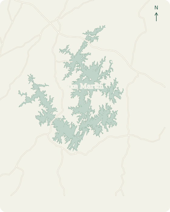 Alexander CityDadevilleEclecticJacksons GapBlue Creek StillWatersWillow PointKowaliga TrilliumThe Ridge WindermereReal Island Equality2 mi
Lake Martin, Alabama © OpenStreetMap
Map sources
Names link to area guides. Lines connect them to verified orientation landmarks; they do not show property or permit boundaries.
- Alexander City center
- Dadeville center
- Eclectic center
- Jacksons Gap center
- Harbor Pointe Marina
- Willow Point Golf & Country Club
- Kowaliga
- The Ridge Marina
- Real Island locality
Road context: U.S. Census Bureau, 2025 TIGER/Line.