Equality, Parker Creek & Real Island seawall repair
For Equality, Parker Creek and Real Island properties, start with the exact parcel and a practical route to the shoreline. Use those details to plan repairs and confirm the permit path.
Describe your project on this page ↓Get to know your waterfront
On the Equality, Parker Creek and Real Island side, be precise about the parcel and access route. Regional and tourism maps distinguish these places and their marina locations, but the Equality mailing area is not a substitute for the county record. Confirm whether the property is on the Elmore or Coosa side and which jurisdiction handles the proposed upland work.
Lake Martin regional map · Lake Martin marinas · Elmore County permit FAQ · Elmore County road access FAQ · Lakeshore use permit request and FAQ
Resolve county and mobilization before selecting a bid
Ask the contractor to identify the proposed loading point and route to your wall. Parker Creek and Real Island are separate marina references; neither directory listing grants commercial staging permission. Confirm use with the relevant owner or operator before relying on it in a quote.
- State the draft or water depth assumed for waterborne equipment.
- Identify ground access that remains usable if the lake level changes.
- Record who pays when the approved route or method must change.
Resolve Elmore versus Coosa jurisdiction from the parcel documents. Use the county’s current answer for the upland work, while keeping Alabama Power’s shoreline permission and the ADEM disturbance review on their own checklists.
Prepare a seawall assessment and organize the project budget.
What could the work cost?
A mobilization allowance should state the assumed route, equipment and water conditions. Ask what happens to the price if the planned access becomes unavailable.
National price ranges help you start a budget. They are not Lake Martin quotes; your wall’s height, condition and access can change the total.
Compare quotes and plan a budget →Find the relevant permits and records
| Starting point | What to resolve | Prepare and look up |
|---|---|---|
Alabama Power Martin Shoreline | Shoreline construction, repair and modification. | Deed, sketch and full scope. 256-825-0053. |
Local jurisdiction | Confirm the parcel and applicable building, floodplain and access review. | Use the office links and the parcel record; do not rely on a postal town. |
ADEM construction stormwater | Non-exempt Lake Martin disturbance, including work below one acre. | Disturbance map, location and complete activity description. |
Resolve county and mobilization before selecting a bid
These local records identify the questions to resolve. A neighborhood description does not establish conditions or approval for a particular lot.
County first
Check the deed and official parcel record before applying rural Elmore guidance. If the property is in Coosa County, obtain a direct answer from that county instead of borrowing a neighboring process.
Separate marina locations
Parker Creek and Real Island are distinct marina references in the tourism directory. Name the intended loading point, then seek the operator’s approval for any commercial use.
Low-water access
Drawdown can expose more shoreline while reducing water depth available for a barge. Ask the contractor which condition their chosen access method needs.
Plan your Equality, Parker Creek & Real Island project
Add the parcel location, the visible concern and any access or timing constraints.
Clear guidance for your shoreline project.
Equality, Parker Creek & Real Island project questions
Can I use Elmore’s rural guidance for every Equality address?
No. Establish the parcel county and jurisdiction first. Mailing areas do not follow every administrative boundary.
Does a low-water season always reduce cost?
No. It may improve land access but complicate water access. The actual method, ground conditions and schedule decide the effect.
Keep planning
Nearby waterfront guides
Show sourcesHide sources
- Lake Martin regional mapSource reviewed 2026-11-04 · official indexed text
- Lake Martin marinasSource reviewed 2026-11-04 · official indexed text
- Elmore County permit FAQSource reviewed 2026-11-04 · official indexed text
- Lakeshore use permit request and FAQSource reviewed 2026-11-04 · official indexed text
- Martin, Yates & Thurlow residential guidelinesSource reviewed 2026-11-04 · official indexed text
- Alabama Power programmatic general permitSource reviewed 2026-11-04 · official indexed text
- Lake Martin special construction stormwater ruleSource reviewed 2026-11-04 · official indexed text
Explore nearby areas.
Equality, Parker Creek & Real Island is highlighted. Choose a place for its shoreline guide and local permit contacts.
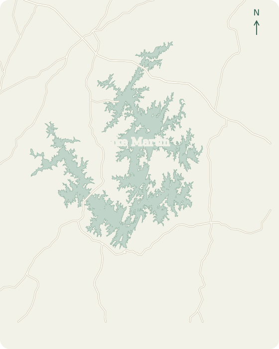 Alexander CityDadevilleEclecticJacksons GapBlue Creek StillWatersWillow PointKowaliga TrilliumThe Ridge WindermereReal Island Equality2 mi
Lake Martin, Alabama © OpenStreetMap
Map sources
Names link to area guides. Lines connect them to verified orientation landmarks; they do not show property or permit boundaries.
- Alexander City center
- Dadeville center
- Eclectic center
- Jacksons Gap center
- Harbor Pointe Marina
- Willow Point Golf & Country Club
- Kowaliga
- The Ridge Marina
- Real Island locality
Road context: U.S. Census Bureau, 2025 TIGER/Line.